Project Overview
PROJECT DELIVERABLE
To promote the development of mapping tools by other organizations, the LEPC will create a best practice guide to mapping regional data while continuously improving our current mapping tool with geospatial labour market data from sources such as Statistics Canada.
Project Timeline
October 1, 2018 to March 29, 2019
Project Status – COMPLETED
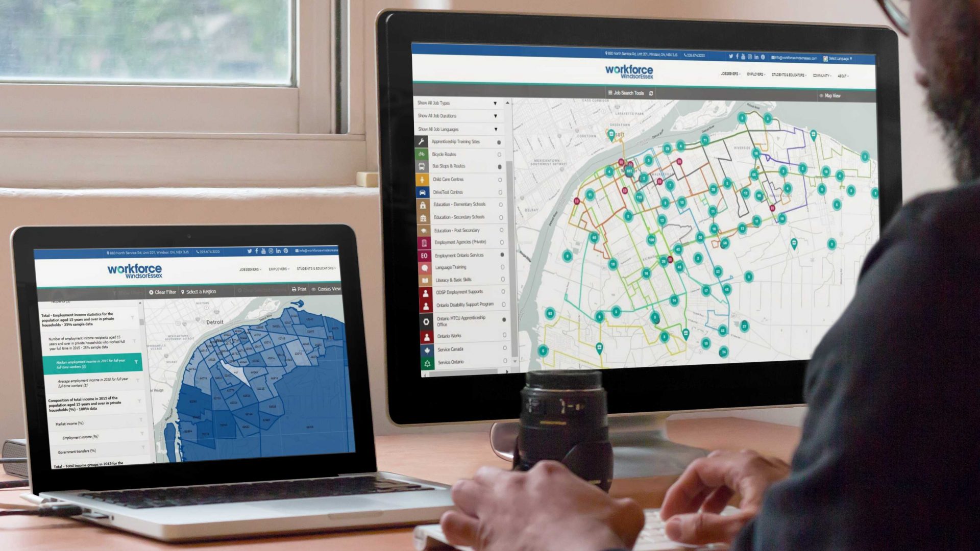
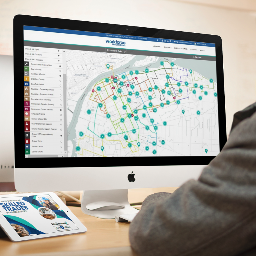
On February 7th we launched the new and improved mapping tool called WEmap jobs. It maps job postings, employment and training related services and assists users with planning their commute. As of May 2019, over 5000 people have used the tool in their job search.
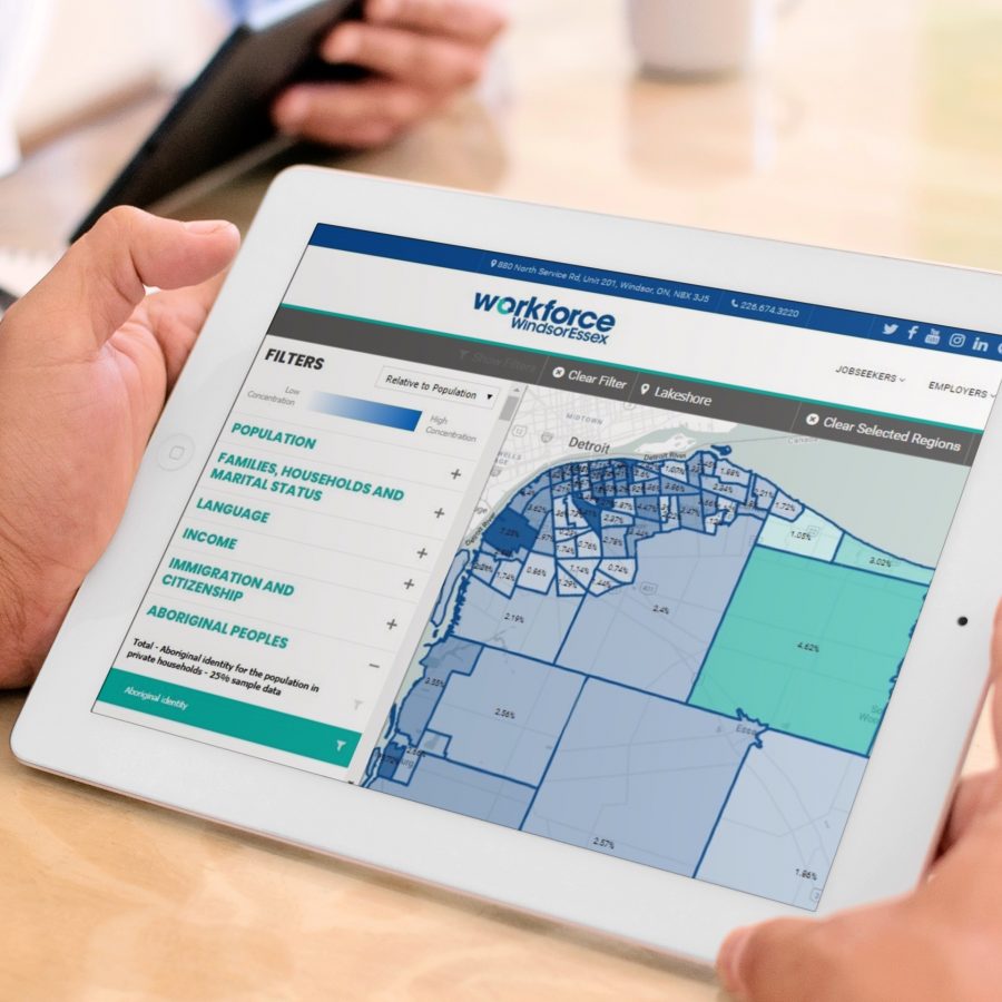
On March 28th, we launched WEmap census to support organizations in business planning, service planning, and research activities. We also launched A Guide to Creating Mapping Tools to empower others in creating their own mapping tools and in making best use of geospatial data.
Click below to access WEmap LMI project deliverables.

Project Rationale:
Visualizing data through mapping is quickly becoming a best practice in helping community partners understand their local services, employment opportunities, and demographics geographically. Communities that map data will see a variety of benefits from the mapping tools. For example, job seekers will be able to better access services and employment opportunities, community organizations and government will have better planning tools at their disposal, and employment service providers will be better able to understand community demographics and assist clients in accessing services and employment opportunities. The Mapping LMI project will feature the creation of a best practices guide and result in the further development of WEmap to incorporate the visualization of Statistics Canada labour market information.
A best practices guide to mapping regional data will help other communities and community organizations develop similar mapping tools. The guide will provide advice and direction on topics such as, mapping software, gathering data, sharing mapping tools and helping community partners use mapping tools. It will be written with scalability, consistency and comparability in mind, so that other LEPCs can more easily develop mapping tools in the future.
In the first phase of the LEPC, we visualized public transit routes and job postings to help job seekers without access to a vehicle determine which employment opportunities they can mostly easily access. Building on this, we plan to add local employment-related services to the map so users can better view which organizations are most easily accessible to them. We will also be visualizing Statistics Canada data to help government, service providers, and community organizations better understand the demographics of our local neighbourhoods and plan services appropriately. Recently we have seen that other organizations have also begun mapping data as a best practice. For example, Statistics Canada recently visualized its 2016 Census data geographically through its Census Program Data Viewer and Service Canada is reviewing service coverage via mapping, however its not common at the community organization level.
WHAT OUR COMMUNITY IS SAYING ABOUT WEMAP:
“WEmap jobs… fantastic development!! WFWE is a blessing to our community.” Bruno Ierullo, Former Executive Director of Employment at Social Services at the City of Windsor
Project Contact:
Julian Villafuerte, Project Coordinator and Researcher
226-674-3220 ext. 850
&
Justin Falconer, Senior Director
226-674-3220 ext. 854